The former hurricane Erin has transformed into a low-pressure system over the UK and is now influencing Switzerland’s weather in a big way.
The south side of the Alps will be hit hardest, with massive rainfall from Wednesday to Friday.
So, if you are in Tessin, or Graubunden, keep an eye on the Meteo Swiss App on your phone for weather warnings and stay safe
- Away from rivers, waterways, lakes etc.
- Keep up to date with local warnings for mountains, landslides could occur
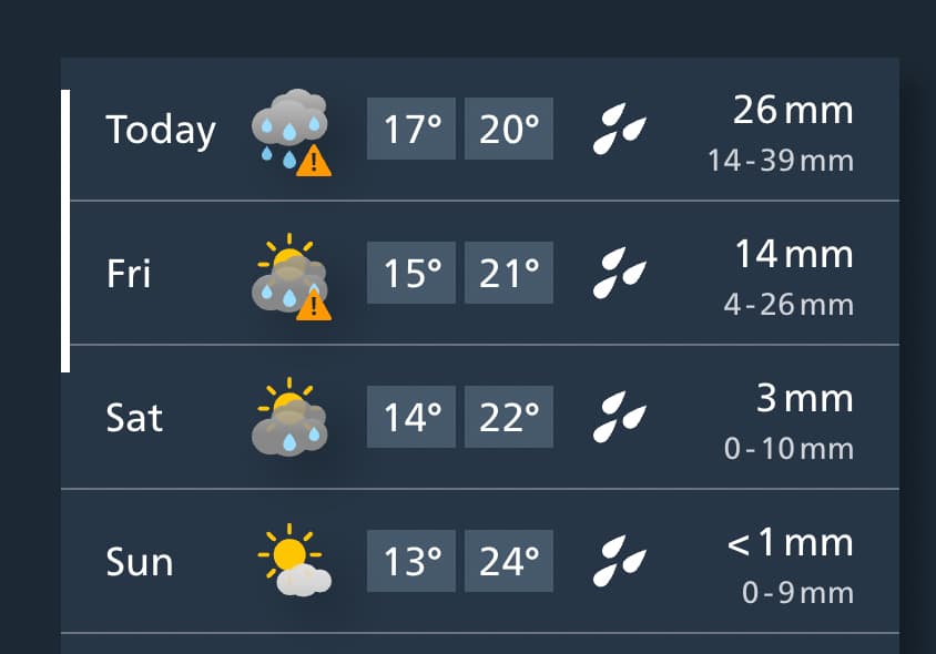
Continued Forecast
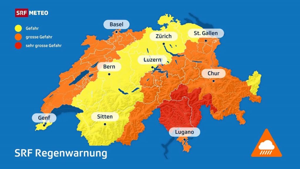
Forecasted rainfall amounts (Wednesday–Friday evening):
Want To Save This For Later?
- Ticino, Misox, and nearby Graubünden regions: 150–250 mm, locally even more – in some places equal to an entire month’s worth of August rain.
- Northern Alpine slopes, Jura, parts of Valais and Graubünden: 70–100 mm.
- Other regions: 30–70 mm.
Even today, thunderstorms are expected in the south and near the Jura (Western Switzerland) potentially with strong winds and hail.
By Thursday, steady rain will spread across the country, especially in the south where floods, landslides, and debris flows are possible. The snow level is above 3,000 m, meaning all precipitation will fall as rain, adding to the overflow risk.
MeteoSwiss has issued at least Level 3 warnings across most of the country, with even stricter precautions in Ticino. For example, access to the Bavona Valley has already been closed due to the increased risk of debris flows.
Options For Rainy Days
For those visiting during these days, you can use the following links for some fun rainy day options
Plan Your Trip to Switzerland
 Luggage Storage: Find out where you can store your store your luggage while you are visiting various places in Switzerland.