The canton of Vaud in the mountainous western corner of Switzerland delights visitors with attractions like the Old Town and Olympic Museum in Lausanne, the surrounding Lavaux vineyard terraces, and popular resort towns like Montreaux.
Bordered by Lake Geneva to the south and France to the west, Vaud is perfect for an active vacation with everything from watersports on Lake Geneva to skiing at Les Diablerets village and ski resort. You’ll find hundreds of great hiking trails to choose from for day treks and lakeside promenades suitable for every preference and skill level.
Find the ideal hike for you and your traveling partners or family from this list of the best hikes in Vaud.
Rochers de Naye via Haux-de-Caux

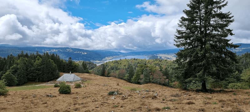
This 12-kilometer-long trail begins at Haut Caux station and goes through the forest to the famous Naye rocks at an altitude of 2,042 meters. The path traverses Le Creux à la CiergeI and Sautodoz. It’s a challenging route with an elevation gain of 900 meters but the reward is a panoramic view over Lake Geneva with the Vaud Alps looming in the distance.
The trail is accessible by a little mountain train from Montreux that takes you to the summit and back again to Montreux. The train also stops in several small towns along the way.
The hike takes between 5 and 6 hours to complete and is popular with birders, hikers, and runners so expect to encounter others on this hike. At Rochers de Naye, make sure to see the pretty alpine garden La Rambertis about 400 meters down a path. It’s open from June to September and is free to visit.
- Hike: Loop
- Distance: 12.4 km
- Time: 5 hr 17 min
- Difficulty: Challenging
Dent de Vaulion
Dent de Vaulion is a moderate to challenging trail loop trail near Le Pont in Vaud. The trail is around 7 kilometers long and takes an average of 2.5 hours to complete. Hiking the trail counterclockwise will allow you to avoid a steep decline near the end.
The trail begins at the Petra Felix Pass at 1,144 meters and passes through lush forests and meadows to the Dent de Vaulion, a mountain peak in the Swiss Jura. You’ll enjoy views of the Joux Valley and the lakes of Bienne, Neuchâtel, Léman, Joux, and Lake Brenet. The trail is well-marked all the way to the summit.
Look for a small hut along the way that serves drinks.
- Hike: Loop
- Distance: 7.2 km
- Time: 2 hr 37 min
- Difficulty: Moderate
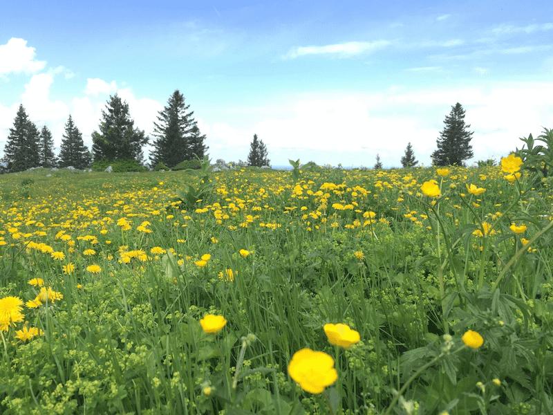
Chemin de La Dôle
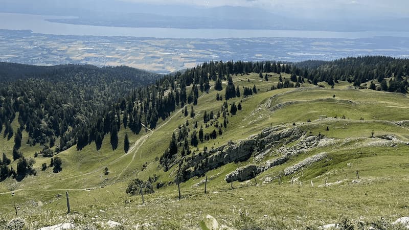
If you’re looking for an easier hike, this panoramic trail starts in St-Cergue overlooking Lake Geneva. The 15-kilometer-long loop trail hike can be done in about 5 hours. The views of the Alps and Mont-Blanc begin right away and continue up higher to the remains of a former castle destroyed during the Burgundian Wars. The highest point is La Dôle, a mountain of the Jura at 1,677 meters above sea level.
Another point with spectacular scenery includes views from the hilltop of La Barillette to the east of La Dôle. This marks the end of the first climb. Reaching the peak, you’ll have a panoramic view of Lake Geneva and Mont-Blanc on the horizon.
The last section of the hike goes downhill and approaches the French border after branching off to the right to Cuvaloup de Crans. The hike ends at the La Grivine railway station.
- Hike: Loop
- Distance: 14.8 km
- Time: 5 hr 16 min
- Difficulty: Challenging
Jura Crest Trail
Switzerland’s oldest long-distance hike, the Jura Crest Trail is a sweeping arc that links Zurich and Geneva. Far removed from mass tourism, the trail has a varied landscape and extensive views. The trail opened in 1905 and leads over the Swiss Jura from one linguistic border to another.
This is a difficult trail that is 320 kilometers long with an ascent of 13,800 meters and a descent of 13,900 meters. It will take about 16 days to complete.
Along the way, you’ll pass through tranquil forests and encounter deep ravines and craggy cliffs. You’ll enjoy distant views of the Alps, the Black Forest, and the Vosges. You’ll notice regional differences such as styles of houses, villages, cuisine, and of course, languages that go from German to French. Plenty of mountain restaurants are located along the way.
- Hike: Point to Point
- Distance: 308.5 km
- Time: 16 Days
- Difficulty: Challenging
The Lavaux Vineyard
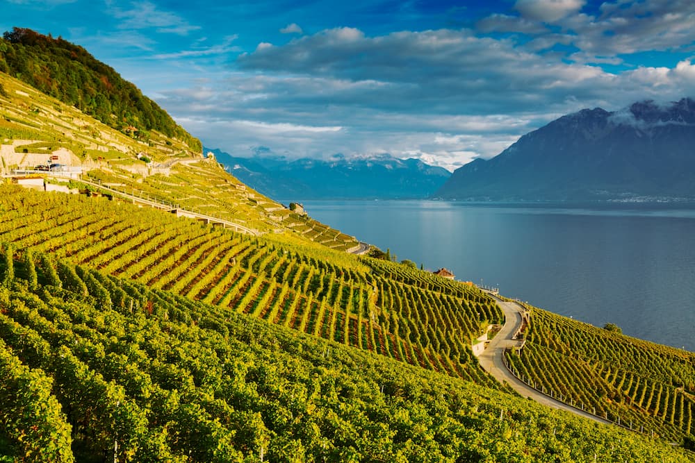
Also known as the Swiss Wine route, this hike goes from Lutry to St-Saphorin via the famous Lavaux vineyards. The Lavaux Vineyard trail is about 11 kilometers long and is a point-to-point trail. It’s moderately challenging and takes a little over 3 hours to complete. It’s open year-round with stunning scenery every season.
Along with the beautiful scenery, you’ll appreciate that you’re in an area of significant history. The wine terraces can be traced all the way back to the 11th century. Today, the area is listed as a UNESCO World Heritage Site.
This is a popular trail, so expect to encounter other hikers, runners, and birders. Dogs are welcome but must be on-leash.
Want To Save This For Later?
- Hike: Point-to-Point
- Distance: 11.3 km
- Time: 3 hr 18 min
- Difficulty: Moderate
Toblerone Trail
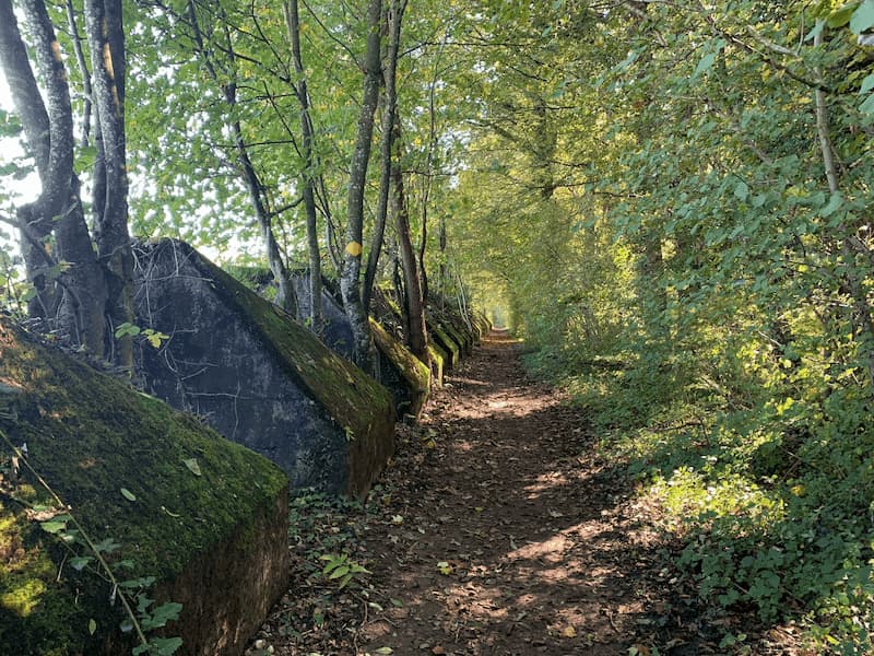
An easy day hike from Geneva, the Toblerone Trail is as much about history as it is about nature and scenery. Hiking along the Toblerone Trail is a lesson about the tank traps, fortifications, and bunkers the Swiss incorporated to protect their country from the Axis forces and ensure its neutrality and safety.
The 10-kilometer hike along the Proment House military defense line begins in Nyon and goes to the Swiss National Museum in Prangins Castle. From here it continues to the Golf Club du Domaine Imperial where you will see fortifications near the lake. The famous Toblerone tank traps are concrete blocks lined up for 10 kilometers and run from Lake Geneva to the slopes of the Jura. The triangular-shaped blocks are immortalized in the Swiss Toblerone chocolate bar today.
As the defense line goes to Bassins and beyond, other fortifications and secondary buildings can be explored along the way including a bunker disguised as a cottage with painted-on windows and of course, the scenic beauty of the area.
- Hike: Point-to-Point
- Distance: 17.9 km
- Time: 4 hr 32 min
- Difficulty: Moderate
Trail Vallée de Joux
If you’re up to a more challenging hike, head to the Dent de Vaulion via Mont-Tendre. Stretching from Lake Geneva to Lake Joux, this point-to-point trail near L’Abbaye, Vaud is kilometers in 33.2 km length and has an elevation gain of 1,735 meters. It takes nearly 12 hours to complete.
The landscape is unique in every season and it’s unlikely you will meet many other hikers along the way. But keep in mind that racing events are held along the trail in October.
- Hike: Point-to-Point
- Distance: 33.2 km
- Time: 11 hr 53 min
- Difficulty: Challenging
Tour des Muverans
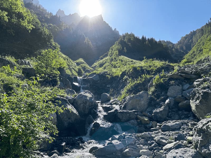
This 4-day trek is a hut-to-hut hike around the Grand Muveran peak in the Valaisian and Vaud Alps. It begins at the peaceful Derborence Lake and leads you through a region of Switzerland that is unknown to many. You will literally be off the beaten path.
The hike isn’t technically difficult, but you should be fit enough to walk for about six hours per day. The trail is 55 kilometers long and has an ascent and descent of 4,380 meters. There are two access points —one at Deborence and one at Pont de Nant. Both can be reached by car or public transport. Alternatively, you can start the hike with the last stage.
The hike is circular with well-marked signs and goes past three mountain lakes. It also features four passes and countless huts along the way for refreshments or to spend the night. The striking views you’ll enjoy on this hike include views of the Valasian and Vaud Alps, Mont-Blanc, and Dents du Midi.
- Hike: Loop
- Distance: 55 km
- Time: 4 days
- Difficulty: Challenging
Pilgrims Way by Lake Geneva

This easy walking route goes from Morges station to Rolle station and passes through breathtaking scenery surrounding Lake Geneva. It begins with a walk through dense woodlands and natural lakeside landscape with secluded bathing spots along the way.
Taking about 4 hours and 35 minutes to complete, the trail passes through the little villages of St-Prex at the mid-point. After that, you will begin to see the vineyard terraces of the wine-growing region of La Côte.
Highlights of the Pilgrims Way walk include the Idyllic spot where the Le Boiron river flows into Lake Geneva, the medieval center of Morges, the picturesque villages of St-Prex and Allaman, and a lakeside promenade in Rolle at the end of the hike.
- Hike: Point-to-Point
- Distance:
- Time: 4 hr 35 min
- Difficulty: Easy
Col du Mollendruz-Romainmôtier
This easy hike begins at the top of the Mollendruz mountain pass and leads along the Jura peaks at an altitude of 1,176 meters. It is 12 kilometers long and takes around 3 hours to complete. After passing through wooded pastures with views of the area around Lake Geneva, it ends at the abbey church of Romainmôtier. You’ll also enjoy views of the Alps and Mont-Blanc.
After crossing Pré de Joux, Chalet Lyon, and Boutavent Dessus, you’ll head in the direction of the charming villages of Romainmôtier and Juriens. Be sure to stop and admire Romainmôtier’s magnificent abbey church, Switzerland’s oldest Romanesque church. A free app is available to learn about the history of the church.
The return hike takes you to Croy-Gare along the river Nozan for a pleasant ending in the lush riverside landscape.
- Distance: 12 km
- Time: 3 hrs
- Difficulty: Easy