If you are heading to Switzerland in the earlier months of the year (April, May and even June) then you need to be aware that many hikes are closed due to snow.
The higher you go, and earlier you come (eg. April vs June) the less likely it is the hikes you want to do are possible.
So, below I have split up a list of fun and popular hikes that you can do (Spring Hiking) and also “may be able to do” (Possible Hiking) for you to plain your visit to the Interlaken area.
Spring Hiking
These are the hikes you can definitely do while in the Interlaken area. Because they are a lot lower and a lot less susceptible to snow.
Of course, if you get a low-level snow dump while you are here (which is still possible in April), then I cannot guarantee that these hikes will be snow-free.
But in normal circumstances, you should have no problems.
Mürren to Gimmelwald
- Hiking time: 1 hour
- Distance: 2.2 km
- Descent: 250m
- Starting Point: Mürren
This very easy walk downhill on the road from Mürren to Gimmelwald should be open most of the year, unless there is heavy snow.
It is not a hiking path per se, but just a road. However, there is rarely any traffic on here, as only locals use it. It offers a great way to soak up the stunning mountain views, with Gimmelwald being the final destination—a cute, authentic Swiss mountain town with very little going on aside from a few places to stay, an honesty shop, and their own beer!
Wengen to Lauterbrunnen
- Hiking time: 1.5 hours
- Distance: 3km
- Descent: 450m
- Starting Point: Wengen town
The epic views from Wengen as you hike down to Lauterbrunnen are hard to beat. The Lauterbrunnen valley, with its jaw-dropping waterfalls and vertical walls, is next-level scenery.
Of course, the Wengen to Lauterbrunnen train offers similar views, so if you have other hikes on your list, this one may not be a top priority.
It can be hard on the knees, so if you suffer from knee pain, maybe skip this one!
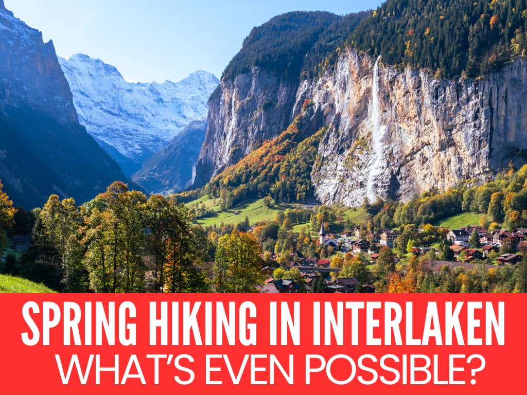
Lauterbrunnen Valley Hike

- Hiking time: 2 hours
- Distance: 8km
- Ascent: 160m
- Starting Point: Lauterbrunnen town (head towards the Staubbach Falls)
This easy stroll along the valley floor in Lauterbrunnen offers stunning views and waterfalls toppling form the cliffs all around you.
This walk follows the farmer’s road (pictured above) from Lauterbrunnen town to Stechelberg and can be walked any time of year in any shoes. It passes by the Staubbach Falls, which should be on your itinerary.
If you want to drop by Trummelbach Falls, which is around halfway to Stechelberg, just be aware it is on the left hand side of the valley, so you will need to cross the river to get there.
Once you get to the end, you can jump on the gondola up to Mürren or all the way to the Schilthorn if you like!
Hike To Or Around the Giessbach Falls

The Giessbach Falls make for a great day out, and you can hike up and around them and to/from the lake. This is a relatively easy hike you can do in spring and you can make it as hard or easy as you like
Want To Save This For Later?
There is also a lakeside trail that starts at Bönigen and follows the stunning shores of Lake Brienz. It isn’t too challenging, but there are some long climbs and descents. However, the views across the lake and into the Alps are a great distraction.
You can also start this hike in Iseltwald (or from the other direction in Brienz) to make it shorter and more enjoyable – around 1.5-2.5 hours, depending on how fast you walk.
Giessbach Falls is really the main attraction on this hike. This incredibly powerful waterfall showers down into the lake, with the stunning Grand Hotel Giessbach in the background.
Potential Hikes (Depending on Snow)
You will need to check if these hikes are open when you are here.
Snow can melt and fall quite randomly, there is no way of knowing before you come.
Some years the higher altitude hikes open in June, other years late snow keeps them closed even in early July.
Bachalpsee Lake from First Mountain
- Hiking Time: 2 hrs
- Distance: 6km there & back one-way
- Altitude change: 150meters
- Start: First Gondola station
One of the most popular and scenic hikes in the Grindelwald area is the Bachalpsee walk from First Gondola Station. It is an easy, gravel, undulating path with a small amount of ascent/descent and a stunning lake view (with reflections of the distant mountains when there is no wind).
You can combine this with a day out on First Mountain; just be aware that the zip lines are crazy busy in summer, so do the hike after you do that.
Männlichen Panorama Trail (& Royal Walk)

- Hiking Time: 1 hr 20 minutes from Männlichen, 2hr from Kleine Scheidegg
- Distance: 4.5km one-way
- Altitude change: 161meters
- Start: Männlichen Gondola station (Google Maps)
The Panorama Trail from Männlichen to Kleine Scheidegg is one of the most popular walks around Interlaken offering stunning views of the “big three” – Jungfrau, Mönch and the Eiger along the way. It is also relatively easy going with little altitude change along the way and an easy path too.

It can also be combined with the Royal Walk from Männlichen, which makes for a stunning day out in the Alps.
North Face Trail – Mürren

- Hiking Time: 2 hr from Allmenhubel (a little more if you go from Mürren upwards)
- Distance: 6.5km one-way
- Altitude change: 130meters
- Start: Allmendhubel top station
The North Face Trail starts above Mürren and is a breathtaking hiking route that offers stunning views of the surrounding Bernese Alps, including the iconic Eiger, Mönch, and Jungfrau mountains.
Eiger Trail
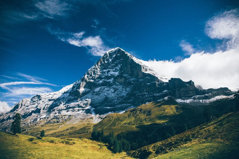
- Hiking Time: 2 hr from Eigergletscher
- Distance: 6.5km one-way
- Altitude change: 125m up, 800m down
- Start: Eigergletscher gondola station
This is a classic walk for those interested in seeing how crazy the climbers are who scale the sheer face of the Eiger. It is a narrow hiking path, but not difficult and mostly downhill to Apliglen (or you can continue even further all the way down to Grindelwald).
It makes for a great trail to connect to the Männlichen Panorama trail, you just have to walk up from Kleine Scheidegg or catch the Jungfrau train one stop.
NOTE: It is perhaps the least likely to open in spring due to the height.