
Nestled in the heart of the Swiss Alps, Grindelwald is every hiker’s dream come true. With dramatic peaks, turquoise lakes, and trails that range from laid-back strolls to epic mountain adventures, this village is pure alpine magic.
Whether you’re chasing jaw-dropping views of the Eiger or just want a peaceful walk surrounded by postcard-perfect scenery, Grindelwald has a trail for you.
Here are the 7 best hikes in Grindelwald — the ones that will make you stop, stare, and say, “Wow, Switzerland really is that stunning!”

The Eiger Trail
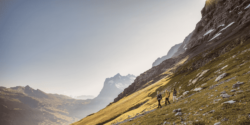
The Eiger Trail is an iconic hike that takes you along the base of the legendary Eiger North Face in Grindelwald, infamous in rock climbing.
It’s a popular and excellent trail to start your trip with, so you can get into the groove before taking on more challenging trails.
The hike winds through rocky terrain, offering breathtaking views of the towering Eiger, the neighboring Mönch, and the Jungfrau.
As you hike, you’ll pass by glaciers, alpine meadows, and waterfalls, immersing yourself in the dramatic beauty of the Swiss Alps.
This is a relatively short hike for the Jungfrau region, but it does have some steep drop-offs despite having a low elevation gain of 100 m on the way up and 800 m on the way down.
The trail starts at the Eigergletscher ( Eiger Glacier) train station and ends at another stop, Alpiglen, where you can get the train back down the mountain. It is mostly downhill, and you can skip the train and follow the trail back to Grindelwald Village if you want to keep hiking.
- Hike Type: Point-to-point
- Distance: Approximately 6.4 kilometers (4 miles)
- Time: 2-3 hours
- Difficulty: Moderate
Panoramaweg: Mannlichen to Kleine Scheidegg

The Panoramaweg (panorama trail) from Mannlichen to Kleine Scheidegg is another popular trail in the Jungfrau Region, and it is doable by all abilities.
It is a rather short trail that offers magical panoramic views of the surrounding peaks, including the region’s iconic jewels: Eiger, Mönch, and Jungfrau.

The trail starts at Mannlichen, which you can access via cable car from Grindelwald. It follows a gently sloping path through alpine meadows.
Along the way, you’ll be treated to breathtaking vistas of the snow-capped peaks. The trail is well-marked and easy to follow, and you can add on more hikes at the endpoint, which is where the Eiger trail begins.
- Hike Type: Point-to-point
- Distance: 4.7 kilometers
- Time: 2 hours
- Difficulty: Easy to moderate
The Royal Walk

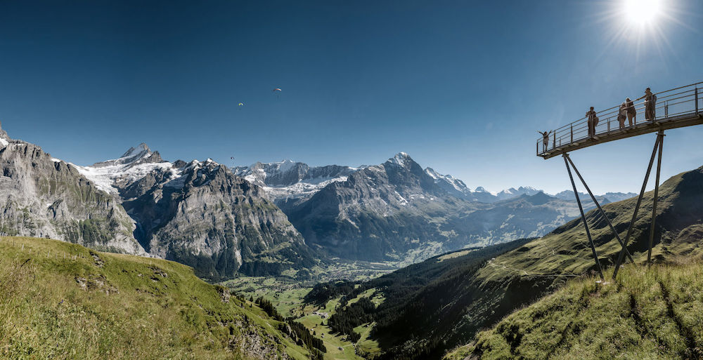
The Royal Walk is a steep but short zig-zag path uphill to one of the most stunning 360-degree lookouts in the region. It is not to be missed, and I recommend it to all my video consult clients.
It can easily be combined with the above Panorama Trail, making for a great morning out with epic views all the way.
- Open: May – October (And in winter – Nov – April)
- Distance: 2 km (1 km each)
- Downhill: 15 min (Peak – Männlichen gondola)
- Uphill: 25-35 min (Männlichen Gondola– Peak)
👉👉 Learn More here
First To Bachalpsee
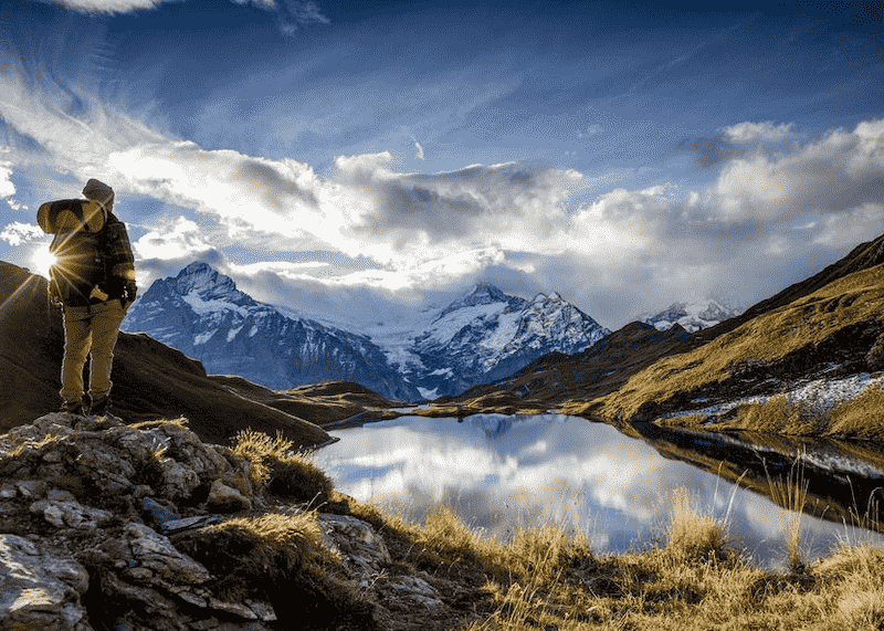
The hike from First to Bachalpsee is pretty much the shorter reversed-loop version of Schynige Platte to First. Starting at the First cable car station, you take a leisurely stroll on the other side of the Grindelwald valley from Eiger on an easy path to the stunning Bachalpsee Lake.
Anyone can do this trail, and you could even do it in flip-flops if you like, so it is one of our favorite hikes for the whole family.
If you can, pick a day without much wind. It will pay off when you see the reflections of Eiger, Monch, and Jungfrau on the crystal clear alpine waters of Bachalpsee. Early mornings are usually best for this before the weather builds.
- Hike Type: There & Back
- Distance: Approximately 6km
- Time: 2 hours
- Ascent/Descent: 150m
Want To Save This For Later?
INTERLAKEN REGION UNCOVERED: A FIRST-TIMER'S GUIDE (UPDATED FOR 2026)
Everything you need to know when planning a trip to the Interlaken, Grindelwald & Lauterbrunnen area.
AFFORDABLE AT ONLY $35

First to Grosse Scheidegg

The hike from First to Grosse Scheidegg is an easy scenic gem that feels like walking through a Swiss postcard. The trail winds along gentle alpine paths with constant views of the mighty Eiger, lush meadows, and peaceful cow pastures.
It’s an easy-to-moderate route, perfect for soaking in the mountain beauty without breaking too much of a sweat. Especially since it’s mostly downhill (100m up, 300m down)
Stop for a treat at the mountain inn in Grosse Scheidegg before catching the bus back to Grindelwald. The views on the way back are just as amazing as the hike!
- Distance: 5.3km (3.2 miles).
- Time: 1.5 hours.
- Altitude change: 100m up / 300m down
- Difficulty: Easy
Glecksteinhutte Hike
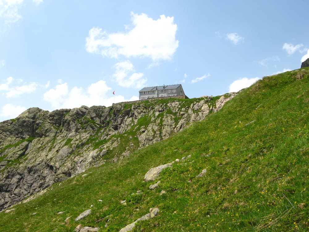
The Glecksteinhutte hike takes you to the charming Glecksteinhutte mountain hut, nestled in a scenic valley surrounded by towering peaks. It offers amazing views along the way. It is not an easy hike and should only be taken on by fit hikers.
If you are very fit, you can hike in one day or split it into two days by staying at the Glecksteinhutte overnight, making it much more manageable. Plus, you can stay in a cozy mountain hut and see the incredible views that come with sunrise.
The hike starts at the Abzweigung Gleckstein bus stop outside of Grindelwald. It then climbs the gorge wall and continues up to the hut at 2316 meters above sea level. It is tough but very rewarding.
- Hike Type: Out-and-back
- Distance: Approximately 9 kilometers
- Time: 4-5 hours
- Difficulty: Moderate
Grosse Scheidegg to Bussalp

The hike from Grosse Scheidegg to Bussalp is a scenic trail that takes you through alpine meadows, forests, and quaint Swiss villages.
Starting at Grosse Scheidegg, the trail offers panoramic views of the surrounding peaks as it heads toward Bussalp.
You’ll pass through flower-filled meadows, enjoy the fresh mountain air, and soak in the stunning landscapes. The hike concludes at Bussalp, where you can catch a bus back to Grindelwald.
- Hike Type: Point-to-point
- Distance: Approximately 14 kilometers / 9 miles
- Time: 5-6 hours
- Difficulty: Moderate
Pfingstegg to Baregg Hut

The hike from Pfingstegg to Baregg Hut is a challenging yet rewarding adventure. Starting at Pfingstegg, you’ll ascend steeply through forests and alpine terrain, eventually reaching the Baregg Hut.
The hut provides a stunning vantage point with panoramic views of the surrounding mountains. You can take a break, enjoy a meal, and soak in the natural beauty before making your way back down to Pfingstegg.
This hike is recommended for experienced hikers seeking more of a challenge. You can stay overnight at the hut to make it a little easier, but be sure to book the hut in advance.
- Hike Type: Out-and-back
- Distance: Approximately 8 kilometers
- Time: 3-4 hours
- Difficulty: Moderate to difficult
Schynige Platte to First (via Faulhorn)

The hike from Schynige Platte to First (Grindelwald First Mountain) is one of the most stunning hiking trails in the area. You can either do the hike in a single day or split it up into two days, staying the night at the lovely Faulhorn hut along the way.
Starting at Schynige Platte, a mountain ridge with panoramic views, the trail leads you through lush meadows and alpine pastures. What makes this hike so special is the uninterrupted view of countless mountain peaks you will see along the way which features the most famous peaks in the region – Eiger, Monch, and Jungfrau.

After the Schynige Platte, you will pass by the Faulhorn, where you can soak in the awe-inspiring vistas. The route then descends through forests and meadows before reaching the endpoint at First where you can grab the cable car back down the mountain.
One of the top highlights of this hike is seeing the stunning landscape reflected in the waters of Bachalpsee Lake close to the First cable car station – if it is a windless day you will get some incredible photos of the lake’s reflection.
- Hike Type: Point-to-point
- Distance: Approximately 16 kilometers
- Time: 6-8 hours
- Difficulty: Moderate to difficult
Frequently Asked Questions
Is Grindelwald great for hiking?
Yes, absolutely, Grindelwald is great for hiking with its network of trails that cater to all levels of experience. From leisurely walks to challenging alpine treks, there is something for everyone and some of the views you can experience along the way are simply mind-blowing.
Which hikes in Grindelwald are considered easier for beginners?
The Panoramaweg trail from Mannlichen to Kleine Scheidegg and the Bachalpsee hike are excellent choices for beginners.
These trails offer some of the most stunning views of all the hikes, are short walks, and the trails are very gentle.
How long does it take to hike down Grindelwald-First?
The hike from Grindelwald-First to the valley typically takes around 2-3 hours, depending on your pace. The descent has beautiful views and it is a great way to extend some of the shorter hikes and save some money on public transport too.


Do we need a guide for these hikes?
Most of the time they are easy and obvious, the harder ones perhaps you should avoid if you think you need a guide.
Hi Ashley
Are any of the trails at the elevation of Grindelwald? I can’t do trails over 5,000 feet. Looking for easy yet beautiful. Thank you.
Most of the best trails are up high, but if you want lower down then check out this post https://switzerlanding.com/spring-hiking-around-interlaken/?swcfpc=1